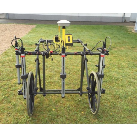
Magnetometer survey system MAGNEX 120 / EPAD / EPAS
New light weight Lithium Ion battery technology
One man operation
From 3- to 5-channel expandable
Flexible probe distance (variable track width)
Probe height adjustable over ground
Rugged design, for use in difficult terrain
Various wheels
Expendable with GPS system
Ergonomic, lightweight design

Download
More info
The EPAD® / EPAS® magnetometer’s multi-channel systems uses the gradiometric principle to detect magnetic anomalies: A ferromagnetic object interacts with the magnetic field in its vicinity, the intensity and field direction (polarity) are evaluated as detection information for localizing the position of the object. It is used for the finding of ferromagnetic objects which are buried underground.
The EPAD® data logger and the EPAS® software are perfectly matched to one another and form the system for recording, processing, visualizing and evaluating digital data for explosive ordnance disposal work. The EPAD® data logger can be used in the field as a single channel or multi-channel system (up to 6 channels). GPS positioning as option.
Typically, the MAGNEX/EPAD data recording systems are linked to global positioning systems (GPS) to accurately record the location of detected anomalies. Subsequently, the data are processed to provide an anomaly location map, target anomaly list, and the measured geophysical signal amplitude for each anomaly. These results are then used by UXO specialists to locate, investigate, and remove the metallic anomaly.
The EPAS® software carries out the complex data processing and evaluating steps automatically in the background. It is characterized in particular by the simplicity of use as well as by its multilingualism. The EPAS® software presents the detection data as two-dimensional colour-coded maps and/or as ISO line charts. The detection data visualization can be superimposed on geographical maps. EPAS® software facilitates interpreting of the objects that have been localized in respect of their horizontal position, approximate depth and orientation. All object data are summarized in tabular form, this information assisting at the excavating of target objects.


 Download (2.21M)